Portal, AZ - Rodeo, NM
Serving The Communities Of Portal and Rodeo (www.portal-rodeo.com)
Serving The Communities Of Portal and Rodeo (www.portal-rodeo.com)

Click On Any Image To See It In Its Original (Larger) Size
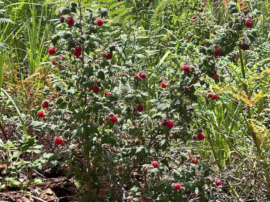
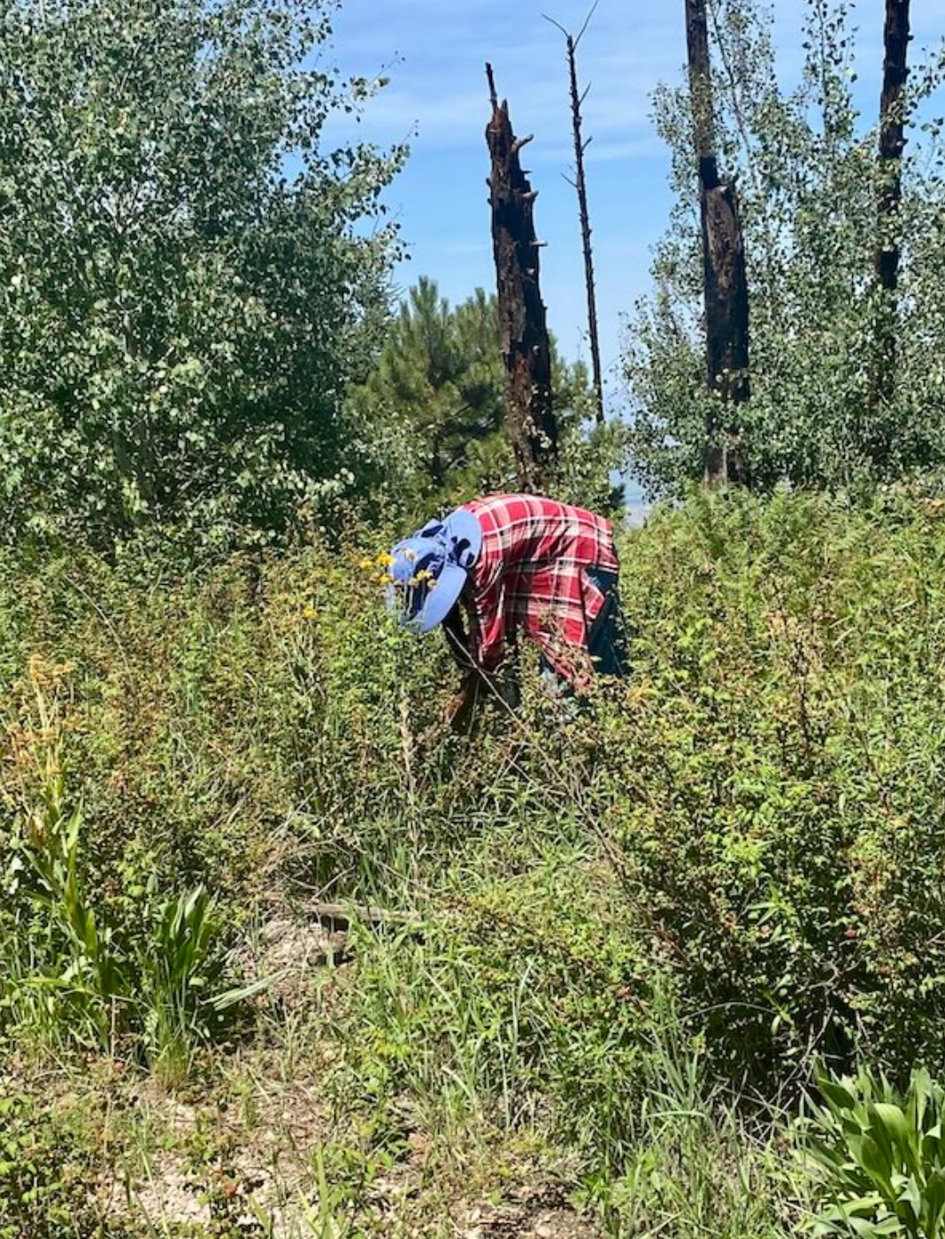
Raspberry Hike Report, Fly Saddle (5 points), 7/30/26:
We apologize for changing the planned hike, but we thought this would be the best week for raspberries, and it proved to be true!
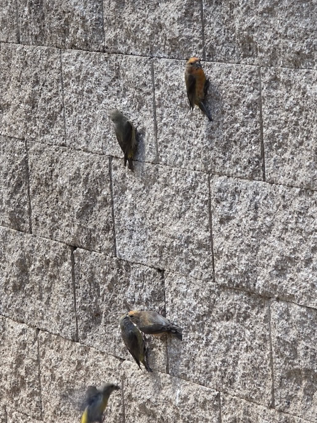
Because of the change we had some confusion about where to meet but it all worked out. Two vehicles drove up to Rustler Park and stopped to marvel at the Red Crossbills eating lime from the restroom walls.
There are lots of flowers in the high country, mostly sneezeweed and verbena with a dozen or more scattered species. Yesterday’s monsoon rains had settled the dust and we saw East Turkey Creek flowing like it used to every summer. We certainly enjoyed the cooler temperature at 9,000 ft. Past Rustler Park the steep and rocky Long Park Road didn’t seem to be as bad. We enjoyed a different bunch of flowers such as Delphiniums, Thurber’s Cinquefoil and a native star thistle. Water-filled puddles were a welcome change from the usual rocky route. Long Park was a green meadow filled with Sneezeweed, Bluebells, Delphinium and of course Bracken fern.
We hiked the trail through aspen stands – now with thick native grasses underneath – out to Fly Saddle. Several types of mushrooms have started to emerge along the route, and at Fly Saddle there were raspberries!
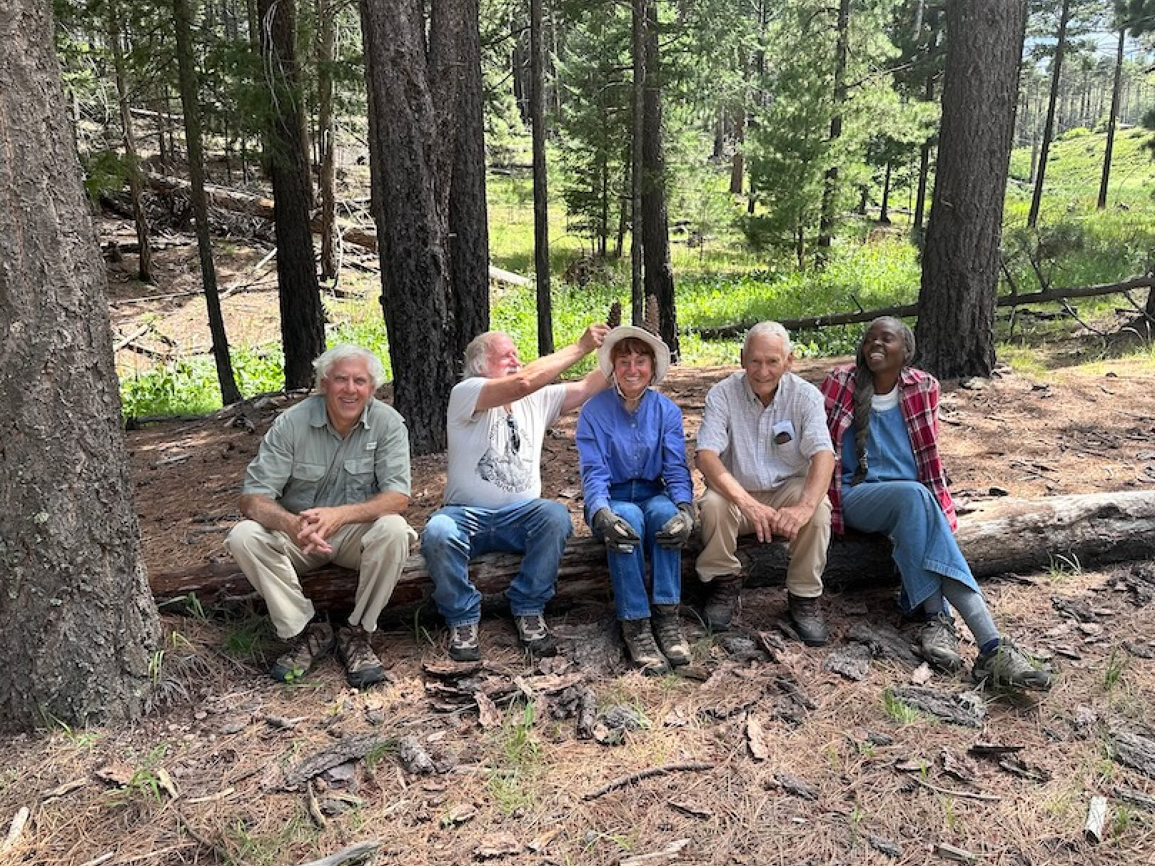
The six hikers went separate directions looking for the best locations. After a couple of hours, we clustered at the edge of the aspen on the trail to the top of Fly Peak for lunch. The few empty containers were filled from bushes in the shade of the regrowing trees. When all were filled (plus lunch containers and at one point a hat and an upside-down umbrella) we headed back to the vehicles at Long Park and home.
Next week we will hike up the South Fork of Cave Creek. The canyon bottom should be comfortably cool in the morning with the cold air drainage, thick tree cover, and flowing water. Creek crossings could be tricky if the monsoon rains pick-up (please pick-up !!). There is little elevation gain for almost 2 miles, then just one steep section. Bring hat, sun protection, lunch, good hiking boots and hat. Meet at the Silver Peak parking lot at 8AM AZ, 9AM NM time. The hike is an “up and back” so people can turn around whenever they choose.
Report from Al, photos from Elaine and Kent
Hiking
August 6 - South Fork Of Cave Creek
Meet at the Silver Peak parking lot at 8AM AZ, 9AM NM
Carol Simon (520) 558-2433 casimon1947@icloud.com
Elaine Moisan (520) 558-5204 emoisan2011@hotmail.com
Elly Van Gelderen (520) 558-3715 or ellyvangelderen@asu.edu
__________________________________________________________________________
Easy Trails
Moderate Trails
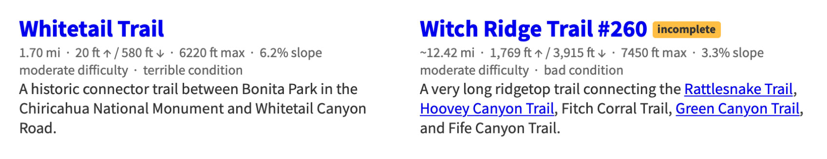
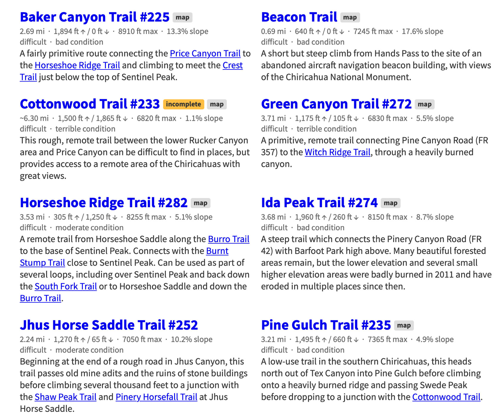
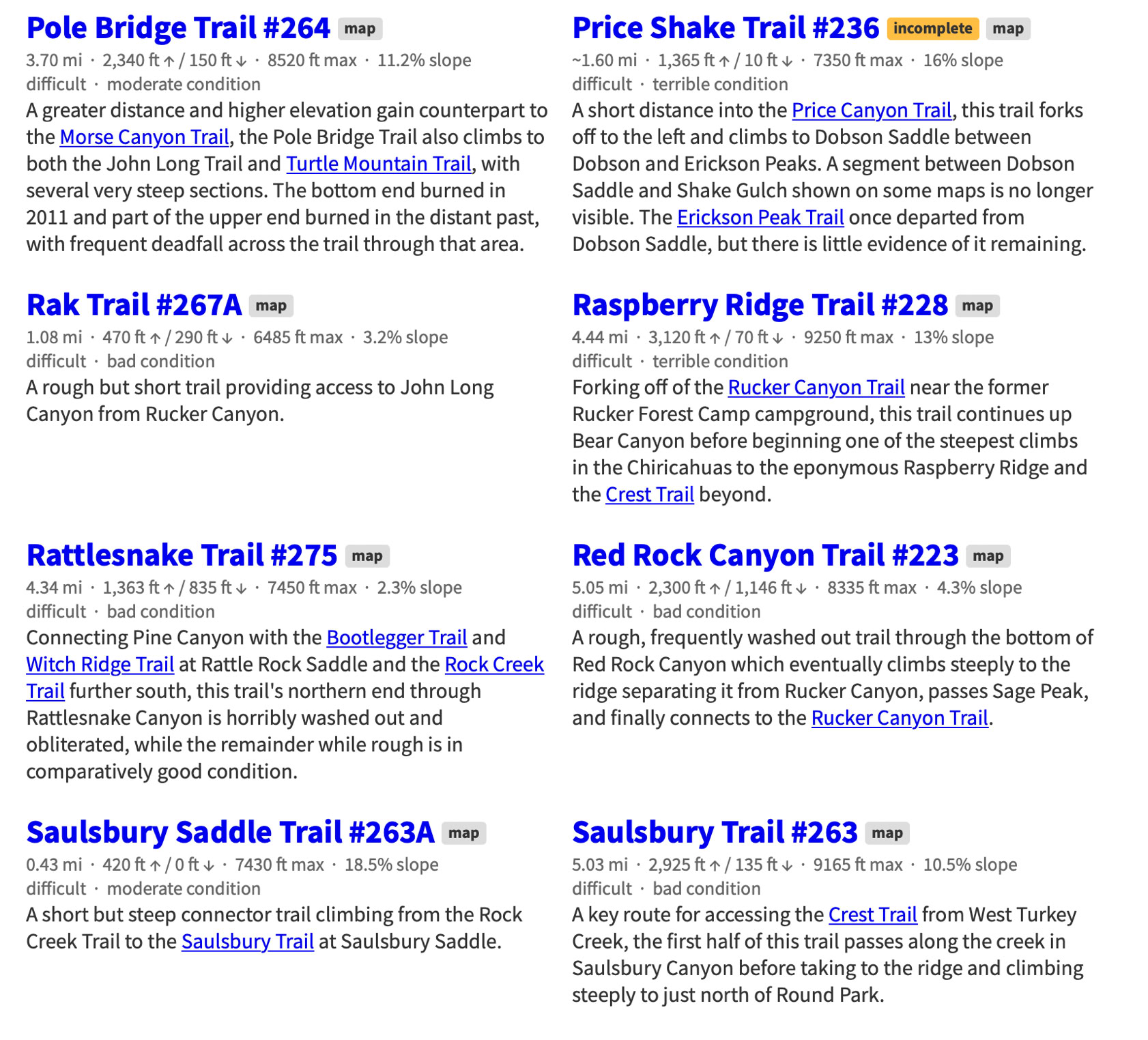
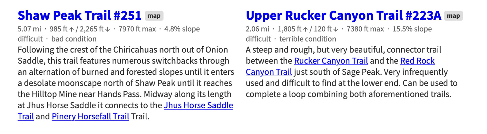
Difficult Trails
Expert Trails
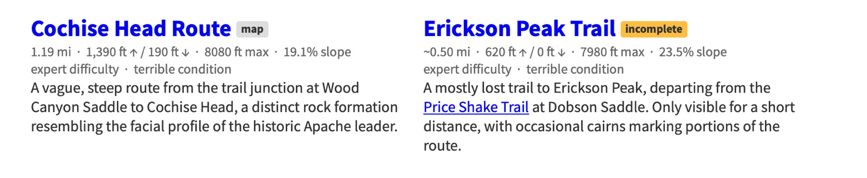
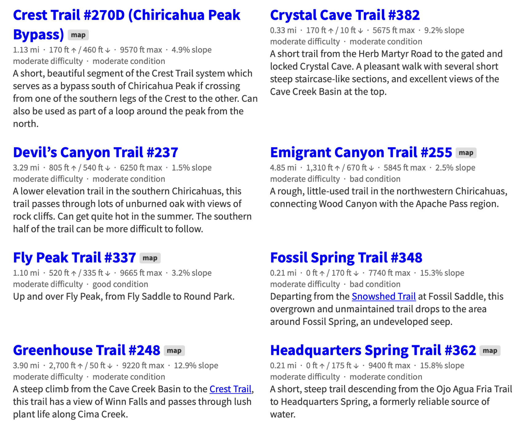
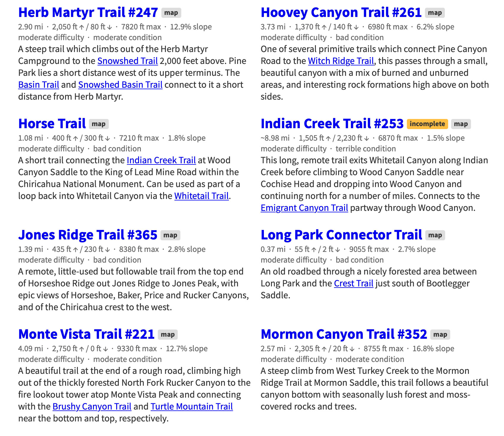
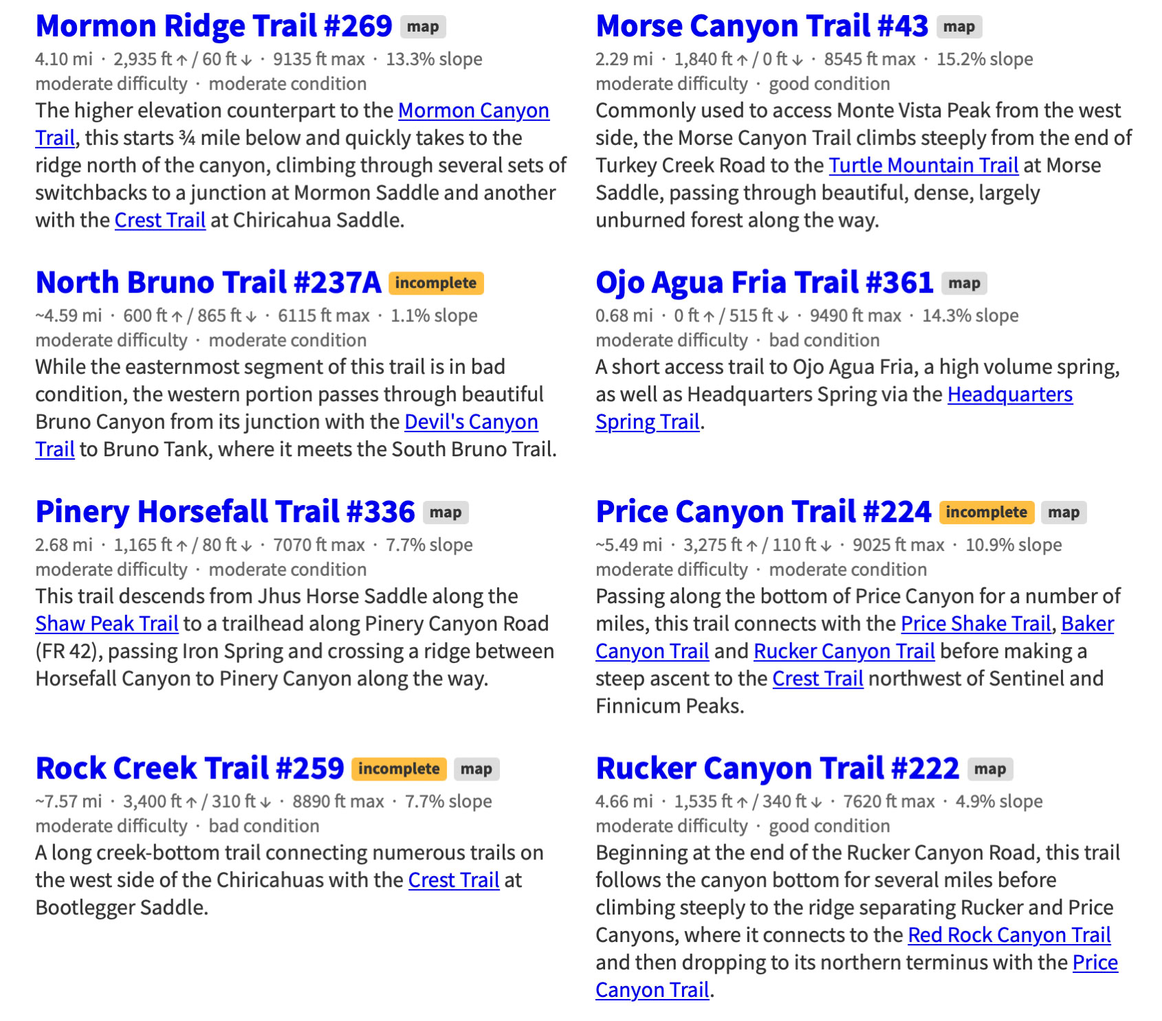
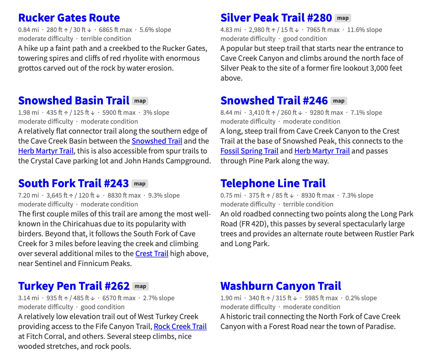
Chiricahua Mountain Hiking Trails
This project -a Herculean task - was started by Jonathan Patt as a collection of GPS data recorded while hiking in the Chiricahua Mountains of Southeastern Arizona starting in 2012 and expanded slowly into this site over a six month period beginning around 2013, during which it became obvious that much of the existing Chiricahua hiking information is out of date and, for some trails, nonexistent. This site is an attempt to resolve that problem.
If you would like to see a map of these trails or want more information about the project visit the Chiricahua Mountains Hiking Trails web site at:
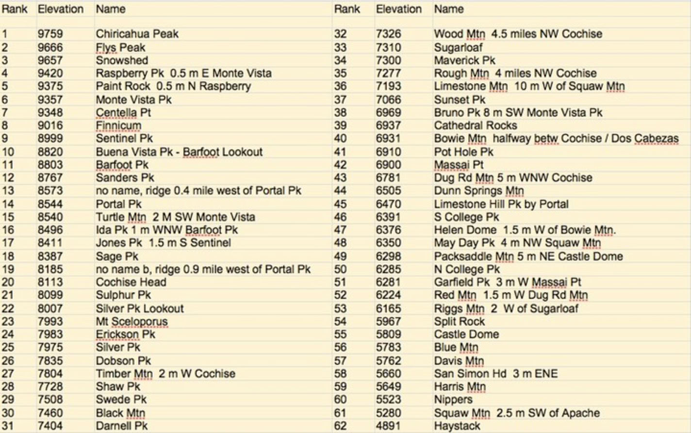
The 62 Highest Peaks, Mountains, Hills, And Lookouts In The Chiricahuas
(Tabulated by Ray Brooks)
(Form Necessary To Work With Trail Crew)
Download - Complete - Mail
To volunteer with the US Forest Service, fill out an application. If accepted, a Volunteer Service Agreement specifying the task(s) will be sent to you.
DOWNLOAD THE FORM. Print it, fill out, sign in block 23, and date. You can scan a signed document and e-mail it toArmando Arvizu at: armando.arvizu@usda.gov
You can also mail the form to Armando at the Douglas Ranger District Office:
1192 W. Saddle View Rd. Douglas, AZ 85607
People can join the list automatically by sending an email to portal-rodeo-hiking+subscribe@googlegroups.com and they should start receiving messages.